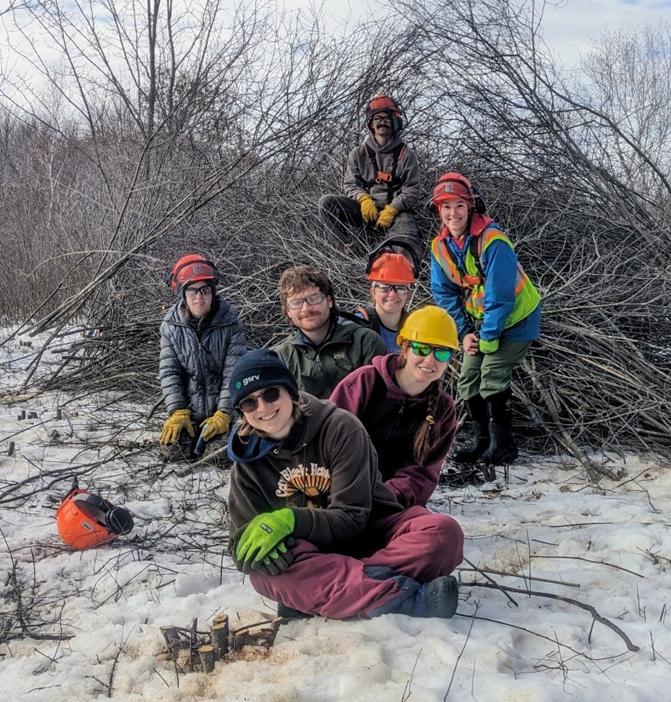
At Soderville Park in Ham Lake, Minnesota, staff from the Anoka Conservation District (ACD) recently tested a new method for disposing of invasive buckthorn. Instead of creating smoky burn piles, they used a biochar kiln called the Ring of Fire.
The Ring of Fire is a type of biochar kiln designed to burn organic material (biomass)—such as wood and plant debris—in a low-oxygen, high-temperature environment. Compared to traditional burn piles, this process is more efficient and significantly reduces smoke, emissions, and environmental impact.
Traditional burn piles turn biomass into ash, which can generate large amounts of smoke, damage soils, and increase erosion. They also leave burn scars on the landscape that can persist for years, creating disturbed areas where invasive species may spread more easily.
How the Ring of Fire Works
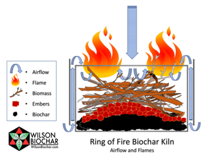
The Ring of Fire works differently. The kiln is packed tightly with sticks and branches and then lit from the top. The flame at the top consumes oxygen from above, while the biomass inside the kiln is superheated with radiant heat. Instead of burning completely to ash, the material below undergoes a process called pyrolysis, in which the heated biomass is transformed into biochar—a stable, carbon-rich material similar to charcoal.
Photo: Illustration of the burning process created by the Ring of Fire biochar kiln and how it converts biomass into biochar. Illustration from Kelpie Wilson. wilsonbiochar.com
When biochar is incorporated into the soil, that carbon can remain stored for hundreds to thousands of years, effectively locking atmospheric carbon into the ground rather than releasing it back into the atmosphere.
Biochar also provides ecological benefits for the soil. Its porous structure can bind excess nutrients such as nitrates and phosphates, reducing their availability and often favoring invasive plants. By capturing these nutrients, biochar can help slow the spread of invasive species that thrive in nutrient-rich environments.
Restoration Benefits at Soderville Park
At Soderville Park, the Ring of Fire also improved safety during the burning process. Since the fire's heat is at the top of the kiln, using the kiln prevents flames from heating the underlying peat soils, which can smolder underground if ignited.
After the burn, the biochar was spread in areas with high weed pressure. By absorbing excess nutrients in these soils, the biochar may give native plants—many of which are adapted to lower-nutrient conditions—a competitive advantage over invasive species.
By turning buckthorn piles into biochar, the Ring of Fire offers a creative way to support restoration goals while reducing smoke, protecting soils, and storing carbon.
- Article and photos by Lauren Schmeltzer
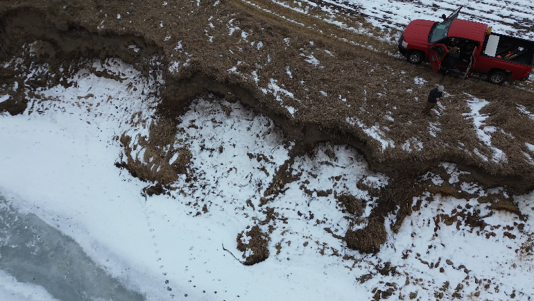
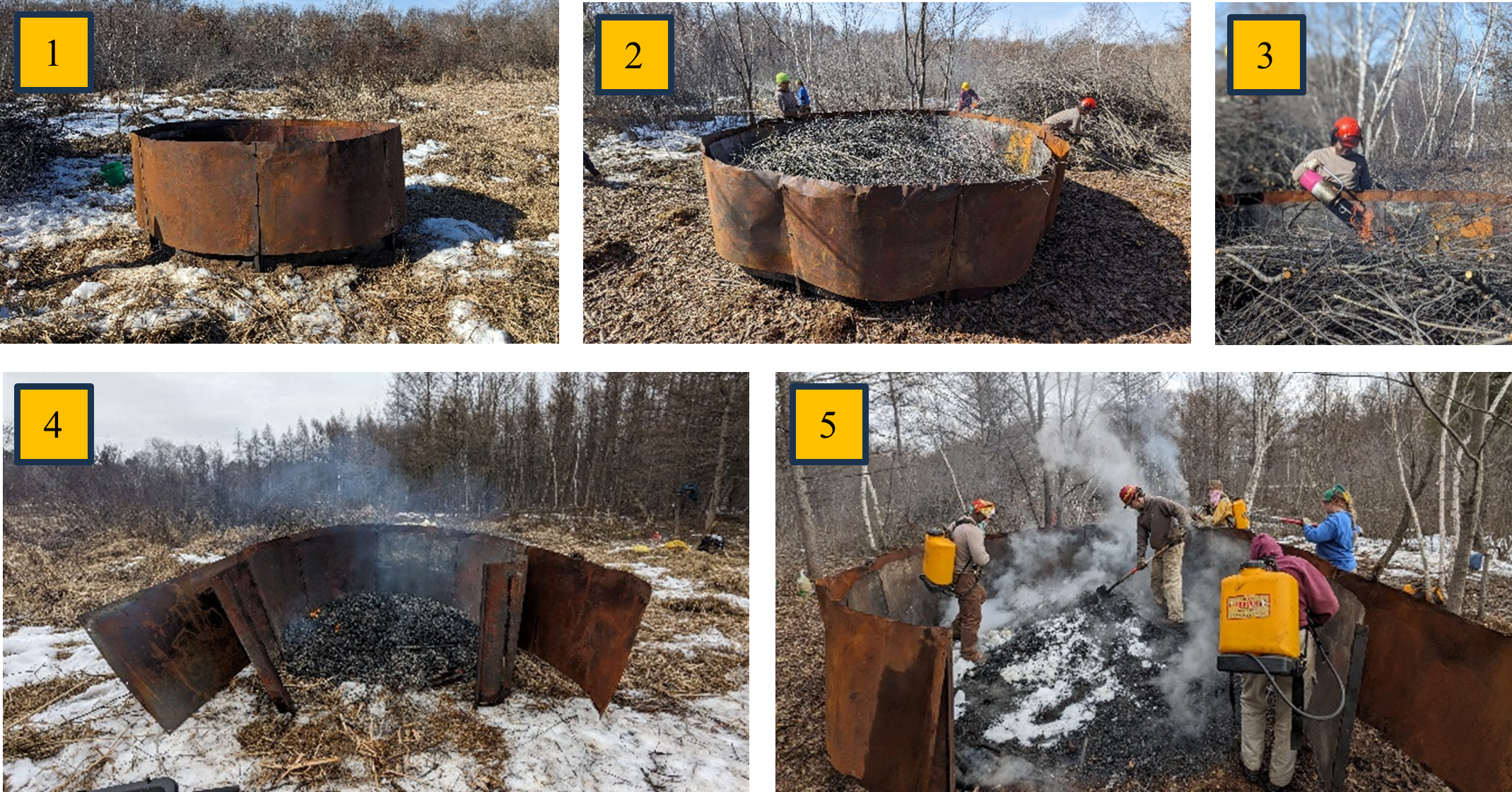
Photo: Shows stepwise burning process using the of Ring of Fire. 1) Construct the Ring of Fire biochar kiln, 2) pack kiln tightly with buckthorn branches and sticks, 3) ignite the biomass in the kiln from the top and continue adding biomass to the pile, 4) once all biomass has been added, let the embers cool and open the Ring of Fire, 5) use water and snow to quench the heat and spread the biochar in the desired area.