Mississippi Community Park Riverbank Stabilization

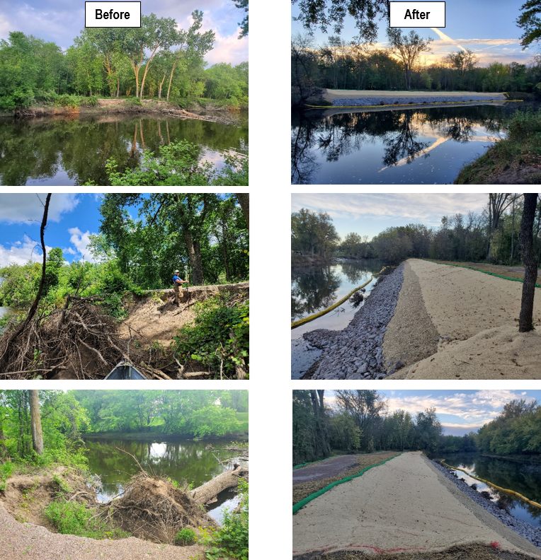
Approximately 1,500 feet of severely eroding riverbank in the City of Anoka's Mississippi River Community Park was stabilized in late 2021. The project included tree clearing, bank reshaping, riprap, erosion control blanket, seeding, and planting a variety of native plant species. Since installation, the site has been subjected to multiple years of high water levels. Both the riprap on the lower elevations of the bank and the vegetation on the upper elevations have successfully stabilized the site. 

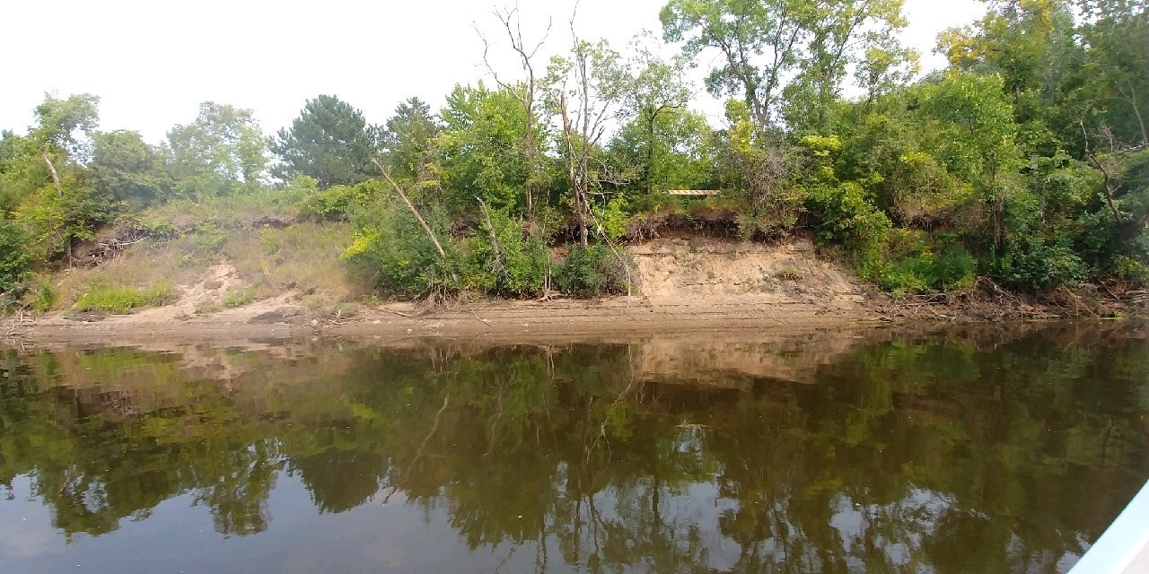
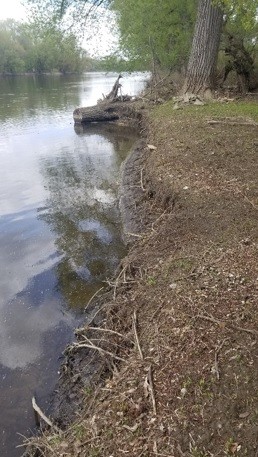
Photo: Mississippi River Community Park, displaying different seasons looking upstream and downstream

Sandbar willows along the top of the rock are filling in densely and provide additional bank stability, wildlife habitat, and a more natural aesthetic to the reconstructed bank. Some of the trees that were planted have struggled, likely due to the 2023 drought, and will continue to be monitored for potential supplemental plantings in the future. Vegetation maintenance is an ongoing process that helps the native species establish. One activity you may observe is mowing to a height of approximately 6" to limit weed species from dispersing seed. For more information contact Mitch Haustein, Shoreline and Stormwater Specialist, at This email address is being protected from spambots. You need JavaScript enabled to view it..

  139 Hits

Funding Available for Cedar Tree Revetments!

What is a Cedar Tree Revetment?
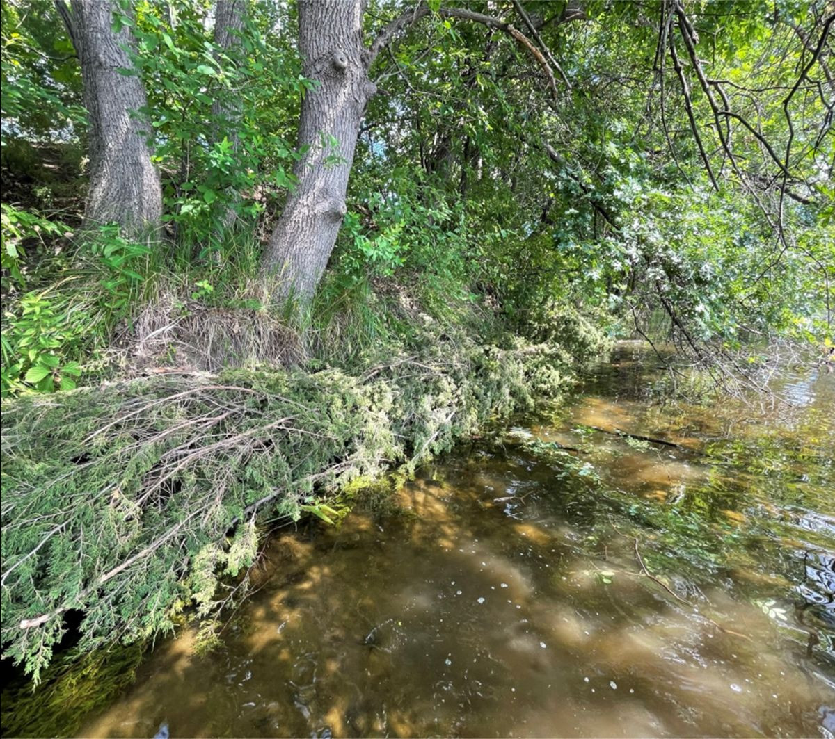
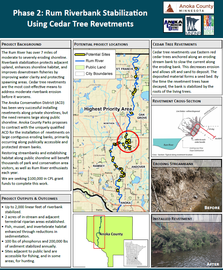
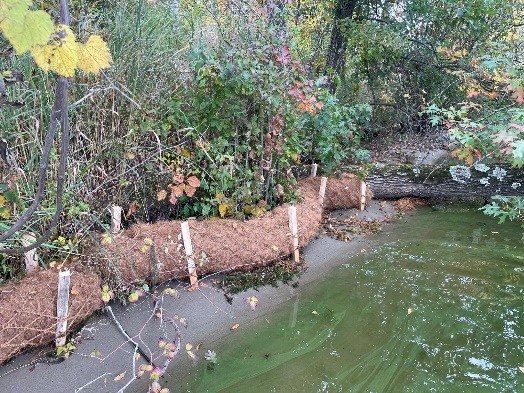
Cedar tree revetments use Eastern red cedar trees to serve as soft, natural armor, providing protection along eroding riverbanks. This protection decreases erosion and allows silt and sand to be deposited overtime. The deposited material forms a bed in which the seeds of riverbank plants such as sedges can grow. By the time the trees have decayed, the bank should be stabilized by the root systems of new plant growth and accumulated sediment. Revetments are ideal for riverbanks experiencing mild to moderate erosion. For riverbanks more than 5 ft. tall or areas with high water velocity, a revetment practice may be inadequate to properly address the issue.

Why Install a Cedar Tree Revetment?

Cedar tree revetments are a low cost, environmentally friendly option to address eroding streambanks. Revetments will slow or stop erosion during the project's lifespan and reduce the likelihood of a much larger and more expensive corrective project in the future. Riverbank erosion contributes sediment and other pollutants into waterways, reduces riparian habitat, and results in property loss. Stabilizing your eroding riverbank will provide water quality benefits to the Rum River as well as protect your property. 

This program is being funded through a Conservation Partners Legacy grant and there is currently funding available to eligible properties. If you live along the Rum River in Anoka County and are interested in learning more about installing a cedar revetment on your property, contact Kris Larson, Water Resource Specialist, at This email address is being protected from spambots. You need JavaScript enabled to view it.. 

  789 Hits

Rum River Revetments Phase 2

ACD was awarded a contract with the Anoka County Parks Department to complete 2,500' of cedar tree revetments along the Rum River in Anoka County between 2023 & 2026. This project is being funded through a Clean Legacy Partners grant that was awarded to Anoka County Parks in 2023. The work will be completed through a partnership between ACD, Anoka County Parks, and the Conservation Corps of MN. 

Accepted Project Proposal

For more information contact Kris Larson, Water Resource Specialist, at This email address is being protected from spambots. You need JavaScript enabled to view it.

  995 Hits

Dellwood River Park Shoreline Stabilization – Project Update

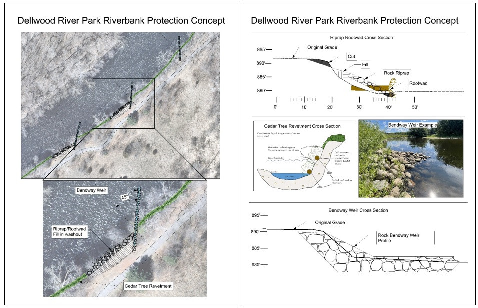
Construction is set to take place in October along 630-feet of eroding Rum Riverbank at Dellwood River Park in St. Francis. Erosion of the riverbank is causing numerous trees to fall into the river and is threatening a popular local walking trail. The project design features three primary protection measures;

  • 1)Two severely eroding zones of riverbank encroaching on the trail will be built back out, armored with rock riprap, and have large tree rootwads added as in-stream habitat elements. The riprapped length of bank will total approximately 180-feet in length. Large boulders will be strategically placed within the riprap to allow enhanced shore fishing opportunity.
  • 2)Three bendway weirs constructed of rock will protrude at 45° into the river. These low-lying, linear features will be submerged under the water (except during very low flows), and will push flow and erosive scour back toward the middle of the channel, rather than along the outer bank. They will also add variable flow areas and habitat value in the channel. These will be great features to cast around for any fisher folks from shore!
  • 3)And finally, the less severely eroding areas of riverbank will be armored with anchored cut cedar trees in a technique called a "cedar tree revetment". Cut eastern red cedars will be cabled together in a shingled fashion along the bank and secured with earth anchors driven into the soil. This is a softer armoring approach than rock which should help the bank stabilize, vegetate, and heal over time naturally before the cedar trees eventually rot away.

For more information contact Jared Wagner, Water Resource Specialist, This email address is being protected from spambots. You need JavaScript enabled to view it. 

  1084 Hits

The Benefits of Simple Lakeshore Practices

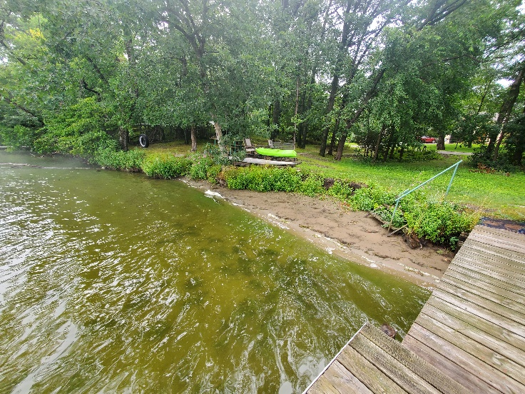
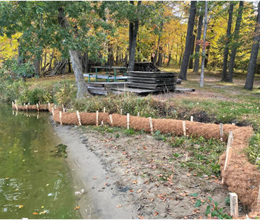
The Anoka Conservation District (ACD) recently installed a 70-foot lakeshore restoration project to mitigate active erosion at a property on the east side of Martin Lake in northern Anoka County. This section of property is heavily used by the family and was a priority to keep intact. The shoreline had receded/eroded back, with certain areas experiencing severe undercutting caused by wave action. These vulnerable sections could lead to additional property loss in the future and contribute to pollutant loading into Martin Lake, further degrading water quality. 

As designed, this project should stabilize the shoreline and allow new vegetation to become established from existing native sources. It is estimated that the project will prevent 1.3 pounds/year of phosphorous from entering the waterbody throughout the life of the project.

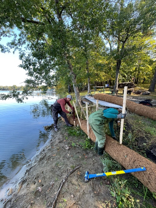
Coir logs are designed entirely of natural materials that are made to biodegrade into the soil overtime. The material is inexpensive, durable, and able to be shaped uniquely to the shoreline. Coir logs can be purchased in different densities, lengths, and diameters, depending on the erosion situation. Compared to other types of erosion control practices, coir logs are low in cost and can be installed by landowners without professional guidance. These practices are also easy to maintain because landowners can fix individual sections that may be damaged over time.

Coir logs protect against wave action and allow banks to stabilize while encouraging vegetation growth. Sections of coir logs are installed in a continuous line near the bank and secured into place using wooding stakes which will also naturally degrade. Aquatics plants are commonly planted into the coir log to provide more enhancement.

This project was funded by the landowner and the ACD cost-share program. ACD provided project administration, design services, and project installation. 

  1058 Hits

KNOW YOUR SHORELINE

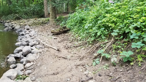
Minor erosion at the toe of slope exposed during low water. If the erosion is addressed early, larger bank failures in the future may be avoided.

If you live on water, whether it be a lake, river, creek, or stormwater pond, low water during the summer months can provide a great opportunity for you to conduct a quick inspection of your shoreline condition. The very bottom of your shoreline, where it meets the water, is called the toe and is the most critical part for stability.

Low water often exposes the toe of the slope and allows you to identify areas of concern. For example, you might observe undercutting, where the lowest portion of the bank has been scoured away by flowing water or wave action. When problems are caught early, the solutions are often much simpler and cheaper. Addressing erosion concerns early also helps prevent more severe bank failures down the road.

Another good time to inspect your bank is in the fall once leaves have fallen and before snowfall. You can inspect the upper portions of your bank for problems like rutting from concentrated overland flow over the top of the bank.

If you have any questions about your shoreline or think a site visit may be warranted, please contact ACD staff. We're here to help. 

  954 Hits

Native Plantings Added to Streambank Stabilization Sites

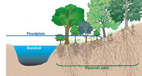
Image sourced from MNDNR Stream Habitat Program

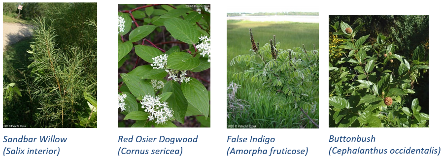
Last year, over 3,000 linear feet of cedar tree revetments were installed on the banks of the Rum River in Anoka County. While the cedar trees themselves will help capture sediment and prevent further erosion throughout the coming years, the re-establishment of native riparian vegetation is essential for promoting long-term bank resiliency. In May, ACD staff, with assistance from Anoka County Parks staff, planted a total of over 1,000 plants across six cedar revetment sites; species planted included sandbar willow, red osier dogwood, false indigo, and buttonbush (pictured below). 

When present, the deep roots of native trees, shrubs, grasses, and other vegetation act like a net, securing the bank's soils and preventing them from washing away. Streambank vegetation also provides essential habitat for many aquatic and terrestrial species. For these reasons, ACD incorporates native plantings into all streambank stabilization projects.

Images sourced from Minnesota Wildflowers. © Peter M. Dziuk
  1291 Hits

“Google River View”: 360° Photos Collected on the Rum and Mississippi

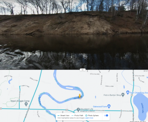
An actively eroding bank on the Rum River

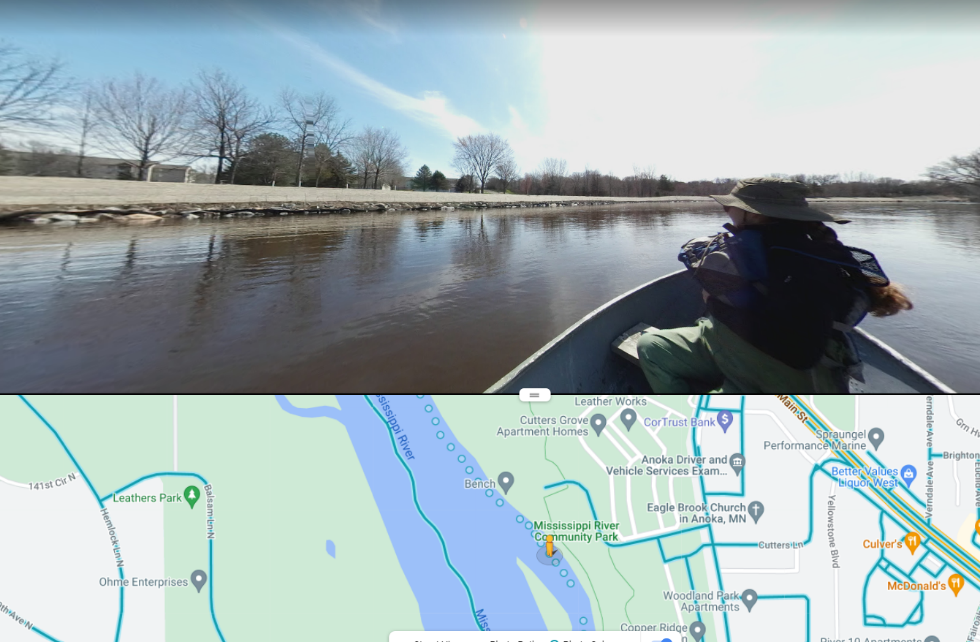
Photos collected from near-shore zones on surface waters throughout the county serve as valuable tools for assessing lakeshore and riverbank conditions. Following a day in the boat with a 360° camera, these photos are uploaded to Google Street View, making them accessible to anyone. ACD then uses these them to compile erosion inventory reports, which describe erosion severity and stabilization project needs on high-priority waterbodies such as the Rum and Mississippi Rivers. Updated photos for these rivers were collected throughout the first week of May and are now available to view (alongside those captured in previous years) on Google Maps.  

While browsing through these photos, you are sure to see a beautiful river view. You may also notice banks currently experiencing noticeable erosion or, alternatively, portions that have recently been stabilized and planted with native vegetation.

A formerly failing riverbank at the Mississippi River Community Park in Anoka, stabilized and planted with native vegetation
  1700 Hits

ACD Partnering with City of Anoka for Mississippi Riverbank Stabilization

Approximately 1,500 linear feet of eroding riverbank within Mississippi River Community Park in Anoka will be stabilized in 2021. The project is currently in the early stages of design and focuses on a stretch of severely eroding riverbank that was documented in an erosion inventory completed by ACD.

Eroding river banks contribute to the Mississippi River's sediment and turbidity impairments through direct loading of sediment and nutrients that degrade overall water quality as well as aquatic and nearshore habitat. Stabilization of actively eroding riverbanks is one of the most cost-effective practices to improve water quality because 100% of the sediment reaches the waterway.

Stabilization techniques will include bioengineering with native vegetation and a rock armored bottom of slope to stabilize the riverbank. The project will reduce pollutants by 529 tons of sediment and 847 pounds of phosphorus annually. Other benefits include aquatic life diversity and abundance, and improved drinking water quality because the project site is immediately upstream of drinking water intakes for the Twin Cities.

This project will also showcase river stewardship and enhance public recreation. Mississippi River Community Park and adjacent Anoka-owned King's Island include 1.7 miles of Mississippi River trail, 0.78 miles of riverfront, 0.91 miles of oxbow channel, pedestrian access to the island, sporting fields, public duck and deer hunting, and a fishing dock. This project will make over ¼ mile of unsafe riverbank more accessible, stable, and fishable for users. By naturalizing the riparian zone, this project complements the Mississippi River Corridor Critical Area rules.

The project is funded by a Clean Water Fund grant, a Watershed Based Funding grant, and match from the City of Anoka. Watch for more updates from ACD and the City of Anoka as the project progresses.

  1304 Hits

Riverbanks, Lakeshores, and Rain Gardens, Oh My! - It's Been a Busy Spring

Anoka Conservation District staff have had a busy spring providing technical assistance to landowners for projects related to water resources. Inquiries about riverbanks, lakeshores, and rain gardens have been particularly common. In total, technical assistance has been provided to over 40 individual property landowners.

Active erosion is the primary reason that prompts people to reach out for assistance with their riverbanks and lakeshores. ACD staff have expertise in a wide variety of stabilization methods and know what it takes to complete a successful project. For example, stabilization projects typically require a formal design and coordination with a qualified contractor for installation. There are also a number of permits commonly required, which ACD staff have experience coordinating. Thus far in 2020, technical assistance has been provided for 13 riverbanks and 12 lakeshores.

Technical assistance has also been provided for 16 rain gardens so far in 2020. Rain gardens are generally categorized as either rooftop disconnect or curb-cut. Rooftop disconnect rain gardens receive runoff from downspouts. Driveway runoff could also be directed to rooftop disconnect rain gardens via a trench drain.Rooftop disconnect rain gardens can be a great do-it-yourself project. Curb-cut rain gardens direct water from the curb and gutter system into a shallow depression in your yard near the road and are primarily constructed by landscape contractors. Once the rain garden fills (typically 1' deep), the runoff bypasses the inlet so there is no risk of flooding your yard. This allows the 'first flush' to be treated, which typically has the most pollutants.

Available funding can be limited, but it's always a good idea to check because new grants may become available from year to year. If funding is unavailable, ACD staff can minimally provide technical assistance. That process typically begins with a phone call or email to learn about the site. ACD staff then conduct a desktop site assessment using available mapping data and schedule site visits when necessary. ACD will also provide assistance with design and construction management, which are sometimes covered by grants.

If you have questions about your property, please contact us. In addition to assistance with projects related to water resources, ACD staff are also available to assist with habitat restoration projects. 

  1518 Hits