Anoka Riverfront Easement Rum Riverbank Stabilization
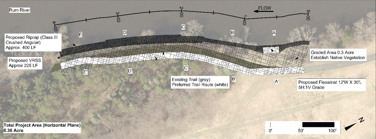
Erosion along 400-feet of Rum riverbank at a City of Anoka riverfront easement is causing sediment loading and tree loss, and has washed out a highly used walking trail. The design features three primary protection measures detailed below.
1. The toe of the bank, mostly below the water line, will be armored with a rock. The rock will be installed up to the two-year flood elevation (50% of years it will be completely covered). This lowers the top of the rock by two feet compared to the standard approach. This allows habitat friendly approaches above.
2. Above the rock, the bank will be seeded with a native plants, and staked with willow and dogwood. Native vegetation provides habitat benefit and root structure to anchor the soil in place. We may grade the bank back to a flatter, more stable slope. Alternatively, we may use a series of wrapped soil lifts called a "vegetated reinforced soil system" to maintain a steeper slope that is still stable and vegetated. The final decision will be based on bids received.
3. There is a heavily used informal access point at the upstream end of this site. This area gets beat down by heavy foot traffic. We will use one roll of articulated concrete block to offer stable footing and reduce the erosion caused by that foot traffic.
For more information contact Jared Wagner, Water Resource Specialist, at
When you subscribe to the blog, we will send you an e-mail when there are new updates on the site so you wouldn't miss them.
