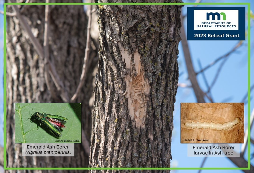
Emerald Ash Borer (EAB) is an invasive insect that has killed millions of Ash trees throughout North America. Since 2009, EAB has been detected in 46 counties in Minnesota, including Anoka County. MN is home to over 1 billion Ash trees, all of which are vulnerable to EAB infection.
Trees affected by EAB dry out and rot quickly, creating public safety hazards. If allowed to decay, these conditions can cause trees to become dangerous to manage. Removing ash trees in high-traffic areas including along public trails and neighborhood streets is a top safety priority. Learn more about Emerald Ash Borer on the ACD Website.
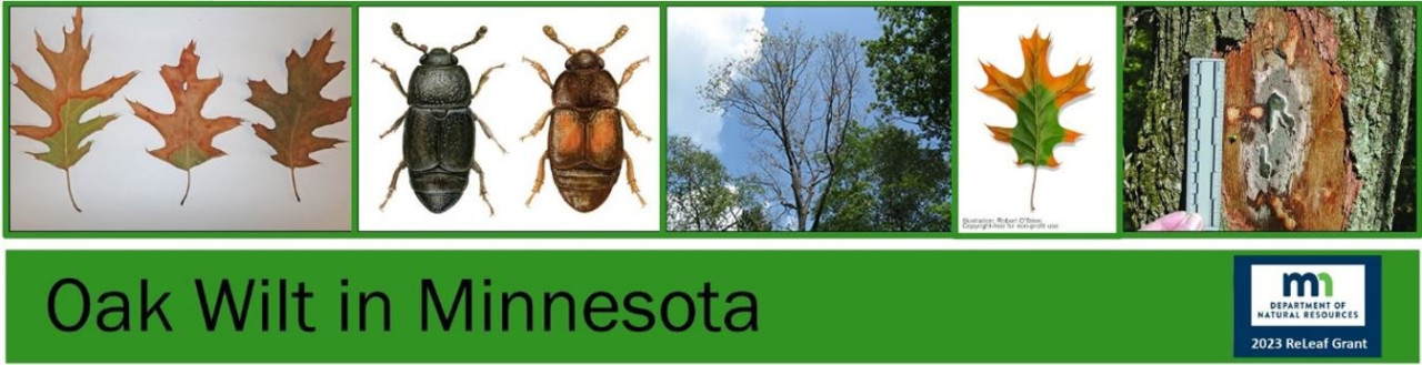
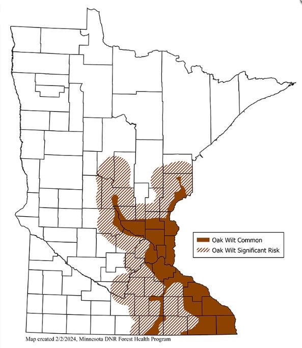
Oak Wilt is a fungal disease that affects all species of oak trees. It is spread by sap beetles and through the tree's root systems. The disease affects Oak species differently; it can kill Red Oak trees in 2-3 months whereas White Oaks can live up to 20 years after becoming infested. It's important to know the signs of Oak Wilt to prevent further forest damage. Learn more about Oak Wilt on the ACD Website.
Help Stop the Spread!
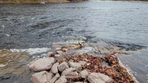
Avoid cutting and pruning Ash trees from May 1 - September 31 as EAB insects are most active during this time. Do not transport firewood offsite from where it was collected. The Twin Cities metro and much of Eastern, MN is within an EAB quarantine zone and transporting firewood out of these areas risks spreading EAB.
Avoid cutting and pruning Oak trees from April 1 through July 31 as sap beetles are most active during this time. Treat spring and summer tree wounds with a water based paint or pruning wound sealer to avoid attracting sap beetles. Do not transport firewood off the site where it was collected. The Twin Cities metro and much of east central Minnesota is infested with Oak Wilt. Transporting firewood out of this area risks spreading this forest disease.
The unseasonably warm winter extends the 'don't prune' window and it probably starts in March for 2024.
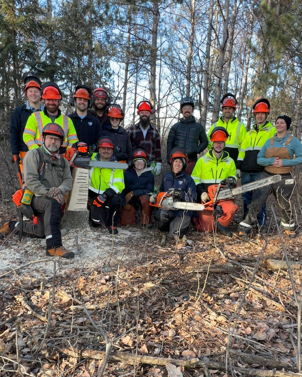
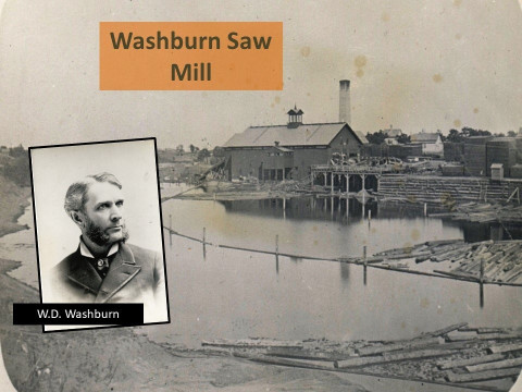
ACD was a recipient of the MN Department of Natural Resources ReLeaf Community Forestry Grant to help efforts to manage Oak Wilt and EAB in Anoka County. A variety of tree species will replace those affected by Oak Wilt in the Anoka Nature Preserve (ANP), including treating Common buckthorn in 2024-25 to free up space for new trees to be planted in 2026. Ash trees at Kings Island in the City of Anoka will be removed in early 2024 and new trees will be planted in 2025. Planting at both of these sites will be completed with the help of volunteers. If you have interest in helping out as a volunteer, sign up here!
For more information contact Logan Olson, Restoration Technician, at This email address is being protected from spambots. You need JavaScript enabled to view it..