Each year, Anoka Conservation District (ACD) supervisors consider the work we've done in partnership with landowners, cities, private sector partners, and other organizations to complete natural resources conservation work in Anoka County. The list is distilled down to a single conservation partner who most emulates a conservation ethic put to action. That individual or entity is acknowledged as Anoka County's Outstanding Conservationist. The 2021 Anoka County Outstanding Conservationist is the City of Anoka.
The projects the City of Anoka implemented in partnership with ACD and on their own over the years have demonstrated an enduring commitment to both steward and enjoy our natural resources.
"The majority of the City of Anoka's successful conservation projects have involved multi-agency collaborations and support; without our partnership and the expertise/guidance from the staff at ACD, many of these projects would not have been possible. The success of these projects involves the hard work of many individuals all working together to create the projects, draw plans, complete grant applications, and monitor construction/projects." – Lisa LaCasse, City of Anoka Public Services Administrator
The following list of conservation initiatives completed by, or in partnership with, the City of Anoka demonstrates their breadth of commitment;
- Donation of a conservation easement to ACD on the 200-acre Anoka Nature Preserve (ANP).
- Enhancement of 70 acres of forest habitats on ANP with buckthorn control.
- Sponsoring annual goose hunts at ANP for veterans.
- Construction of the state of the art stormwater treatment facility at the Rum River boat launch.
- Installation of several stormwater treatment hydrodynamic separators.
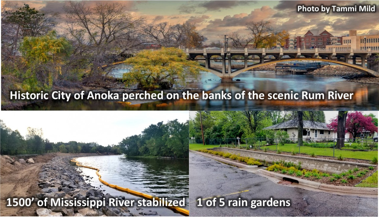
- Installation of five rain gardens.
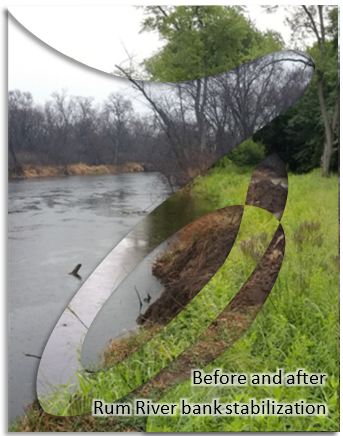
- Stabilization of 300 feet of riverbank at Rum River shores.
- Stabilization of 1,500 feet of riverbank at Mississippi Community Park
- Enhancement of bank stability on 350 feet of Rum River shoreline with cedar tree revetments on school property with the city trail easement
- Enhancement of floodplain forest at Kings Island Park
- Wetland enhancement at the ANP
- Subwatershed retrofit modeling and analysis on 1,500 acres of city-scape.
Lisa LaCasse, Public Services Administrator for the City of Anoka, cites the extensive work to restore habitat at the Anoka Nature Preserve as one of the conservation projects that saw a lot of benefits for both native plants and wildlife, as well as for people. A large quantity of invasive buckthorn was removed and the area was part of a prescribed burn to promote the growth of native species. The City continues to maintain the area through cutting back regrowth of buckthorn and spot-treating as necessary. LaCasse views this project as a huge success because the City and residents are beginning to see growth of desired native plants as well as improved habitat for wildlife. In addition, the removal of the dense buckthorn underbrush has improved archery deer hunting opportunities. Often, community volunteers are able to participate in invasive species removal projects like this one and come away with a sense of connection to the habitat they worked to enhance as well as a sense of pride for a job well done. "It's easy to see the progress and immediate improvements from these types of projects." – Lisa LaCasse
This acknowledgment is part of a larger program, wherein SWCD's from throughout MN submit their outstanding conservationists to the MN Association of Soil and Water Conservation Districts in nomination for the MN State Outstanding Conservationist. In early December, at their annual convention each outstanding conservationist is recognized during a large banquet whereat they will also unveil the state winner.
Congratulations on this well-deserved award and thanks go to the City of Anoka council and staff for all they have done. Projects upcoming in the City Anoka include new rain gardens to capture and infiltrate stormwater, hydrodynamic devices, modifications to existing storm ponds, and stabilization of the Rum River shoreline to reduce erosion. ACD staff and supervisors genuinely look forward to partnering with the City of Anoka on projects in the future.