Where will this snow go?
As spring snowmelt and rainwater rushes down your street and into the nearest stormwater drain, you may contemplate its ultimate fate and journey along the way.
In a natural landscape, much of this water would evaporate or soak into the ground – destined to support vegetation or join the groundwater below – while the remainder would move downward along the surface to nearby wetlands, lakes, and streams. In developed landscapes, impermeable surfaces such as roofs and pavement prevent water from soaking into the ground while manmade drainage networks rapidly channel it to local waterways.
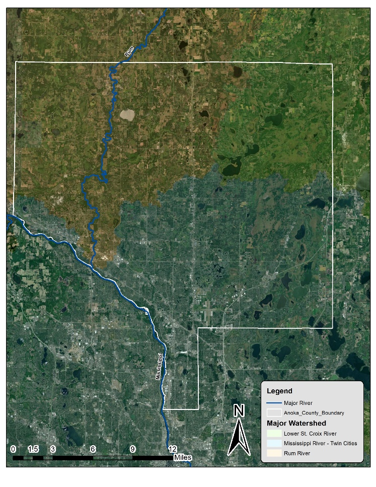
Anoka County contains many interconnected lakes, wetlands, streams, and rivers that receive and transport stormwater. Unfortunately, many of these have experienced increased pollution, erosion, and flooding as a result. Management practices such as rain gardens, bio-swales, and storm ponds have been established throughout the county to intercept stormwater pipes and ditches, decreasing the pollutant load and total amount of runoff entering our surface waters.
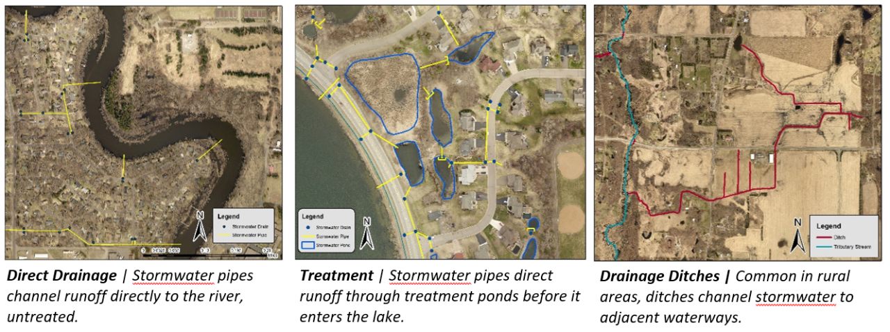
Ultimately, all of Anoka County drains into the Mississippi River – either directly from the land near its banks, or indirectly through its many tributaries (such as Coon, Cedar, and Rice Creeks, and the Sunrise, Rum, and St. Croix Rivers). The path that stormwater takes to these major rivers is unique to each neighborhood, city, and watershed; the figures below show examples of stormwater drainage scenarios common in Anoka County.
ACD pursues a variety of projects that reduce the amount of untreated stormwater entering our waterways; learn more about these by viewing our interactive projects map here. You can also help reduce the amount of pollutants entering your neighborhood's stormwater by following the practices listed here.
When you subscribe to the blog, we will send you an e-mail when there are new updates on the site so you wouldn't miss them.