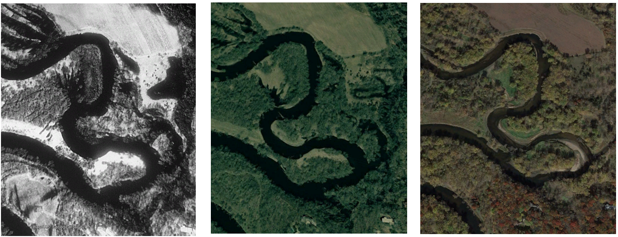
The Oxbows of the Rum River
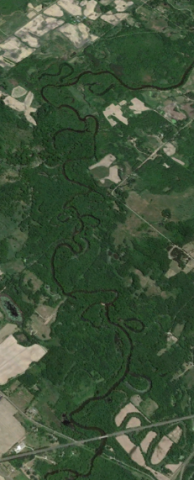
When allowed to wander freely, rivers flowing throughout a gently sloped landscape form a snakelike meandering path. This occurs as the fastest moving waters erode banks along the outer bends, and slower moving waters deposit sediment along the inner bends. Over many years, these processes cause the meanders to curve more intensely, causing the river to eventually loop back onto itself and cut a straight path through the narrow slice of land that remains. Now disconnected from the river, the C-shaped meander scar is called an oxbow.
To watch these processes in action, check out this video: Why Do Rivers Curve?
A quick glance at aerial imagery reveals numerous oxbow wetlands alongside the Rum River. They are rich in plant and animal life, serving as a "nursery" for fish, invertebrates, and amphibians in their early life stages while providing habitat for countless migratory bird species. These oxbows also improve water quality and reduce flooding by capturing water and the contaminants it carries following large storm events.
To learn more about the importance of oxbow wetlands and their utility in water resource management, read the Nature Conservancy's article on the topic here: What is an Oxbow?