ACD Plays a Critical Role in Getting Golden Lake Removed from the Impaired Waters List

Photo Credit: City of Circle Pines

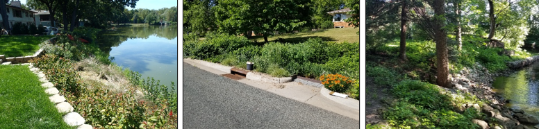
Golden Lake is the jewel in the crown of the City of Circle Pines. Over the decades, clear water gave way to murk and algae. A focused effort over the last several years by many local partners and residents leveraging state funds has turned the lake around; enough so that Golden Lake is being removed from the Impaired Waters List.

At 57 acres, Golden Lake is relatively small, particularly compared to the watershed that drains to it of over 6500 acres. With so much water flowing in from such a large area, Golden Lake is considered a 'flow through' lake, with the water ending up in Rice Creek. Golden Lake essentially acts like a bathtub with the faucet always turned on and a drain always open. Enough water comes in to replace all of the water three times every couple years. This is why efforts to clean up the water, started by installing projects upstream in the watershed.

Working with the City of Blaine, the Rice Creek Watershed District and $88,950 from the Clean Water Fund, Anoka Conservation District retrofitted a stormwater treatment pond in Blaine with an iron-enhanced sand filter bench installed along the perimeter. Iron holds on tight to phosphorus enabling this small project to reduce phosphorus by 11% of the goal to meet State water quality standards. Completed in 2015 at Centennial Green Park, water now filters through the iron-enhanced sand filter before entering the ditch and making its way to Golden Lake. The success of this project inspired a larger effort a bit downstream. 

Photo: Golden Lake

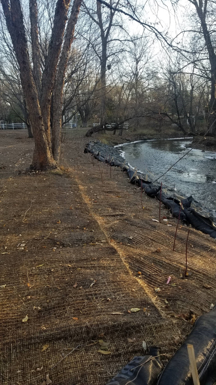
With a $467,970 Clean Water Fund grant, the City of Circle Pines, Rice Creek Watershed District, and Anoka Conservation District hired WSB to design and oversee installation of a pump-controlled iron-enhanced sand filter basin near an existing stormwater pond on Circle Pines-owned property adjacent to Golden Lake. Completed in 2019, water is pumped from an existing pond to two iron-enhanced sand filter beds, before it reaches an outlet to the lake.The project was designed to remove 50 pounds/year of phosphorus entering the pond from Anoka County Ditch 53-62, which carries stormwater runoff from about 6,425 acres.

"Without the Clean Water Fund, neither of these projects would have gone in the ground. Typically, the financial hurdles are often the hardest to get over, and the Clean Water Fund provides a fantastic opportunity to bridge that gap," said Mitch Haustein, Anoka Conservation District Stormwater and Shoreland Specialist.

These projects alone would not have been enough. Groups like the Friends of Golden Lake have helped to spread the word about lawn care to reduce fertilizer and chemical inputs into the lake, stabilizing eroding shorelines, installing buffer plantings, and allowing rooted weeds to grow to help suck up the phosphorus so algae doesn't. Over the past eight years, RCWD monitoring data show phosphorus levels are down 20% to 50% compared with the longtime average dating back to 1976. "The lake is as healthy as it's been in decades – thanks to the ongoing efforts by many" per the Friends of Golden Lake at www.facebook.com/friendsofgoldenlake/. Let's keep working together to  keep it that way!  For more information contact Chris Lord, District Manager, at This email address is being protected from spambots. You need JavaScript enabled to view it..

  702 Hits

RAIN GARDENS FOR RICE CREEK - UPDATE

Six rain gardens will be constructed on residential properties in a City of Fridley neighborhood adjacent to Rice Creek in 2022. The properties were identified as priority rain garden locations in the Lower Rice Creek Stormwater Retrofit Analysis (SRA) completed by Anoka Conservation District in partnership with RCWD.

The priority rain garden locations identified in the SRA were used to target landowners for rain garden installation in conjunction with a mill and overlay project in the same neighborhood. Based on landowner interest, ACD provided site assessments and designs, which resulted in the six rain gardens to be installed.

Stormwater runoff that flows by each of the rain garden locations is currently piped directly to Rice Creek. Curb-cut rain gardens at these locations will provide reductions in runoff volume, total suspended solids, and total phosphorus reaching Rice Creek, Locke Lake, and ultimately the Mississippi River. Cumulatively, the contributing drainage area to the six proposed rain garden locations is nearly five acres and comprised of medium-density residential land use.

Because this area of the watershed is fully developed, large regional options for treatment are limited. The six proposed rain garden locations are optimally positioned because they have large contributing drainage areas for the neighborhood, provide sufficient space for appropriately sized rain gardens, have minimal utility conflicts, and either have appropriate underlying soils for infiltration or are adjacent to a storm drain for filtration.

ACD staff worked with landowners of the six properties to size rain gardens appropriately for each contributing drainage area and position the rain gardens in approved locations. Designs accounted for existing landscaping, yard slope, underlying soils and utilities, and landowner requests. Planting plans were also developed in collaboration with landowners to incorporate requested native species.

The project will be funded through a combination of the Rice Creek Watershed District's Water Quality Grant Program and the City of Fridley. The landowners will be responsible for ongoing maintenance of the rain gardens.

Watch for additional updates as the rain gardens are installed in 2022. To see other rain gardens already installed throughout Anoka County, please see the virtual project tour on ACD's website. 

  1376 Hits

RICE CREEK BANK STABILIZATION PROJECT IN THE CITY OF FRIDLEY

The Brua property located on Rice Creek in Fridley had approximately 85 linear feet of streambank with active erosion. Sediment and nutrients from the eroding bank directly entered Rice Creek. While the erosion severity was classified as moderate, the landowners observed the bank receding over the last several years, particularly during periods of extended high water. By being proactive and addressing the erosion at an early stage, they can minimize the overall cost of the project as well as the sediment and nutrient loading to Rice Creek.

The stabilization solution used a minimal amount of riprap and native plantings to stabilize the eroding face. The shady conditions of the site, frequent water level fluctuation, and flowing water required a hard armoring solution along the bottom portions of the slope. Native species well adapted to frequent water level fluctuations and shady conditions were planted above the riprap to soften its appearance and provide a vegetated buffer with habitat value (see picture to right).

Stabilization of the shoreline will provide reductions in the total suspended solids (2,838 pounds per year reduction) and total phosphorus (1.21 pounds per year reduction) reaching Rice Creek. In addition to the water quality benefits to Rice Creek, downstream waterbodies (Locke Lake and the Mississippi River) will also benefit.

The project was funded through a combination of the Rice Creek Watershed District's Water Quality Grant Program and the landowner. For more information please contact Mitch Haustein, This email address is being protected from spambots. You need JavaScript enabled to view it., 763-434-2030 x150

Stabilized bank on Rice Creek includes riprap at the bottom of the slope and native seed, shrub stakes, and erosion control blanket at the top of the slope.
  2027 Hits